 BURST
BURST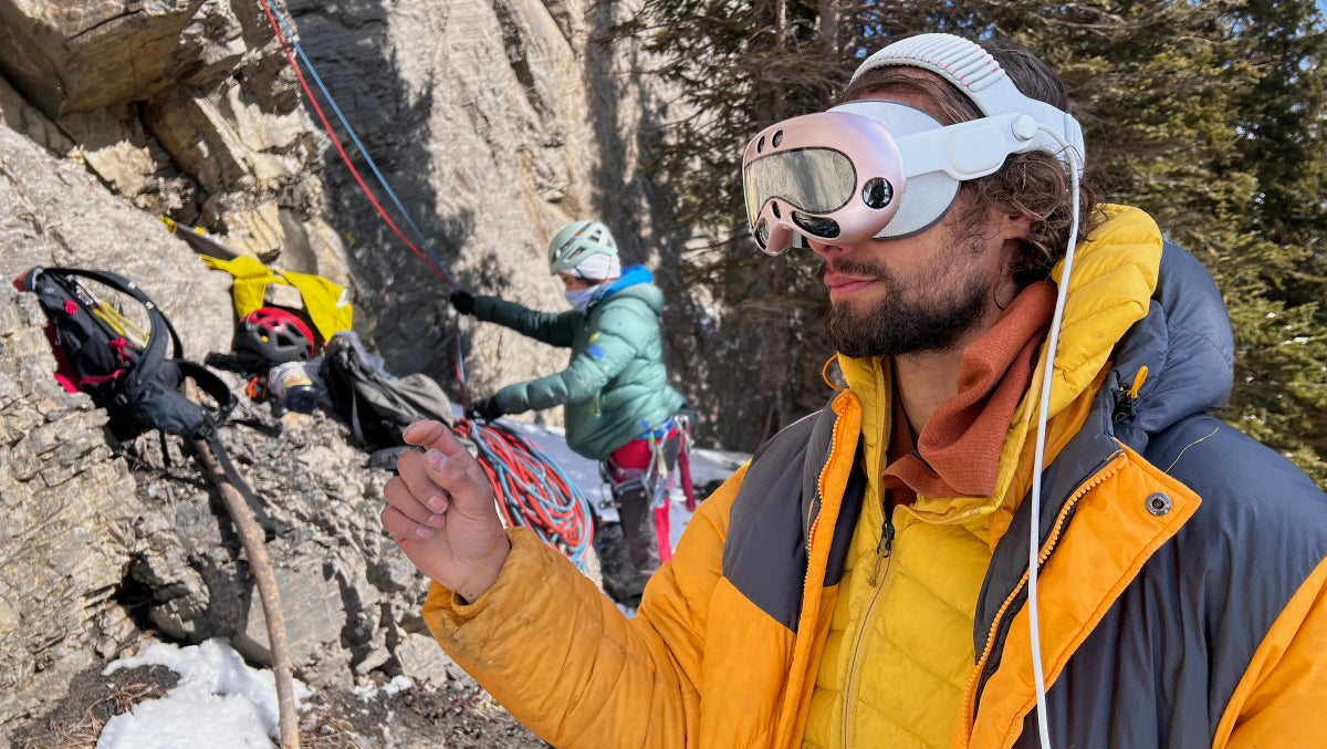
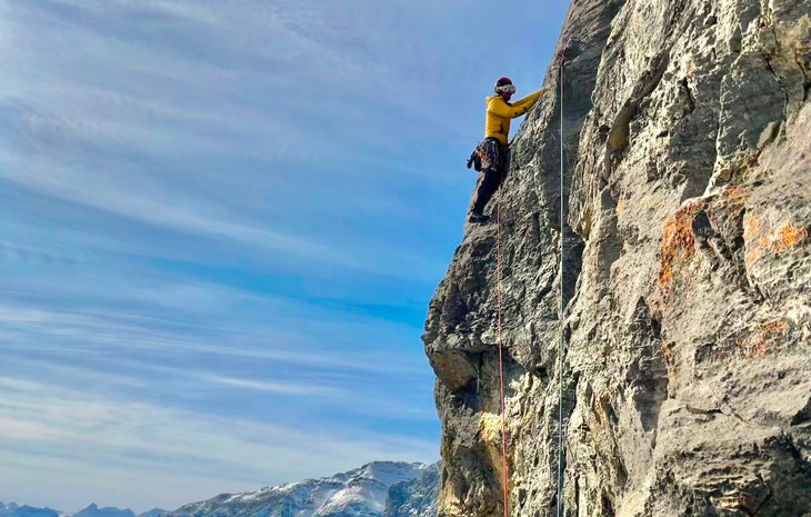
Aside from the holographic line blazing up the route in front of him, it was a rather normal day at the crag for Ben Pearman. Catching a brief weather window in the chilly Rockies spring, he and two friends headed for Red Shirt (5.8+), a classic trad climb up the steep limestone of Mount Yamnuska in Alberta.
As they approached, Pearman thought back to his first time climbing the mountain—which is notorious for difficult route-finding—via a different route known as the King’s Chimney (5.7 PG13). He and his friend had such a hard time finding the base of the climb that he remembers saying, “Damn dude, in the future, you could probably just wear AR [augmented reality] glasses and see where the start of the route is.”
Now, he was back—with AR goggles—and he could indeed see the route’s start, and so much more.
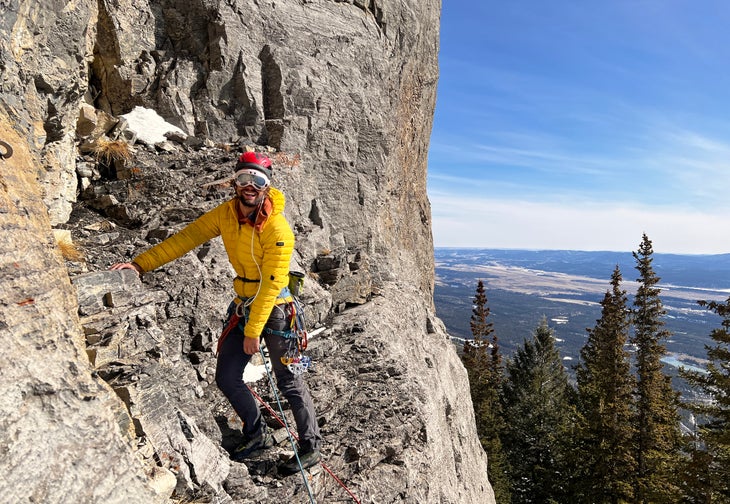
Heading up the first pitch with Apple Vision Pro goggles strapped to his face, Pearman could see not just the rock in front of him, but a tiny model of the entire route projected off to the side. As he climbed, the goggles’ cameras fed data to an algorithm trained on a miniature 3D model of the cliff, showing him exactly where he was on Red Shirt.
If he needed beta, Pearman could switch to the immersive guidance mode, where icons floated along a glowing line projected directly onto the rock ahead. If all this visual overlay became annoying, he could whisk it away and switch to chat guidance mode, talking directly to an AI assistant trained to give advice about this specific climb.
“Am I still on the route?” he asks.
“You’re almost at the bolt,” the goggles reply in the voice of one of his friends (you can customize voices in the app). “Keep heading left!”
Augmented reality and 3D topos enter the climbing chat
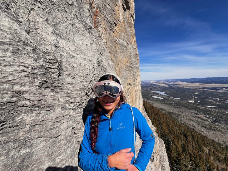
Pearman was testing out RockXR, an experimental app that he’s developed to make use of augmented reality and spatial data in outdoor climbing. While the day when climbers throw AR goggles into their packs is likely far in the future, the spatial dataset he used is coming to climbing—and fast—as new apps take advantage of leaps in data science.
A graduate student in computer science and an avid climber in Calgary, Pearman has been merging his skillsets for a while. Most of his work focuses on combining data and technology to create apps like Sloper Ice and Mixed, an open-source database for ice climbing in the Rockies, and StraVis, which turns Strava activities into digital art.
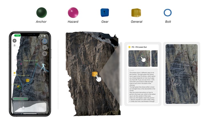
While RockXR is a prototype that will likely stay in the lab for now, he recently released another climbing-focused offering: ThreeTopo. This app brings a miniature, 3D model of Red Shirt to your phone, annotated with the route info and its important features like bolts, anchors, and even beta for gear placement.
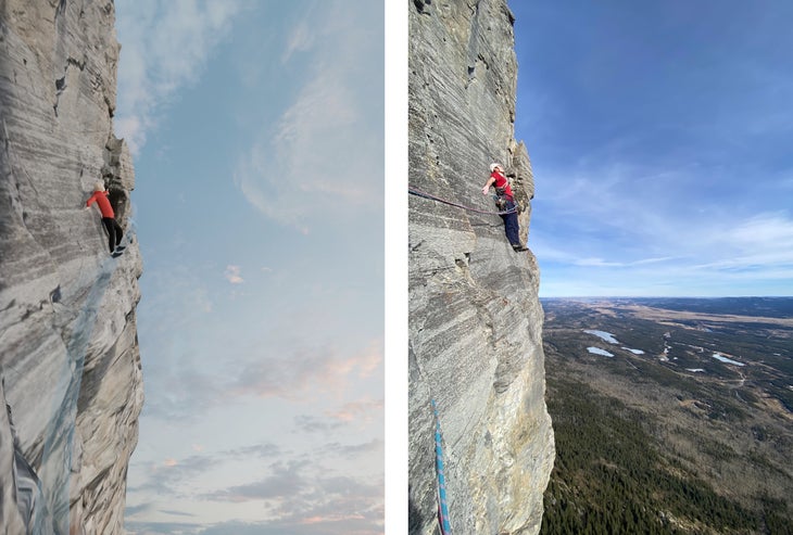
Pearman designed this three-dimensional topo map app to be used with one hand, allowing climbers to easily pull out their phone when they need a bit of beta on route. This 3D topo shows them every detail of the rock, bypassing what Pearman sees as subjective interpretations found in traditional guidebooks. ThreeTopo is currently available only for Red Shirt, but Pearman plans to open source his process, allowing anyone with technical ability and a drone to start building 3D topos for other routes themselves.
“I think that every single route in the world will have a description like this in the future,” he said.
The onset of spatial data apps in climbing
Pearman’s creations aren’t the only apps to leverage spatial data to serve climbers. Rock Garden and Red-Point have mapped thousands of climbs along the contours of 3D models of entire cliff faces. Shadō uses similar 3D models to predict where and when shadows will fall across a crag in the hot desert sun. Inspired by the technology used by plant-identifying apps, RouteGoat can tell which route you are standing in front of from a quick photo of the base of the wall.
Of the maelstrom of climbing apps that barrage the modern climber, most essentially function as advanced spreadsheets, giving you information about climbs or calculating your performance statistics. The latest spatial data apps, however, represent a new generation of climbing information technology. By applying increasingly accessible spatial data and artificial intelligence, they’re revolutionizing route-finding—and we’ve only begun to scratch the surface.
“We’re at a place right now with technology where people can see easier or better solutions to the common problems they have with rock climbing,” said Pearman.
While we tend to think of the major innovations in climbing as improvements in equipment, a parallel advancement in information technology has revolutionized our ability to create and share climbing knowledge—for better or worse.
How topos and beta sharing are evolving
From the first scratches of a topo on a piece of paper, to the development of guidebooks with full-color images of thousands of climbs, our ability to communicate information about a route has progressed dramatically. Through a quick search of online databases, you can now find information on just about any climb on the planet.
Some of these new and forthcoming apps aim to solve for the shortcomings of guidebooks, which, of course, have never been perfect. Authors must squish a complicated, three-dimensional structure onto a two-dimensional page. Flakes get flattened, dihedrals get spread, and climbers often find themselves confused.
Like many other climbers, Berk Frei has more than enough stories of accidental orienteering missions. When he founded Rock Garden, he hoped that applying a 3D format to guidebook info would help climbers visualize their climbs beforehand. His app allows users to step into the route itself, helping them feel more prepared and (hopefully) spend less time faffing around in the lichen off-route.
“Spatial data invites the opportunity to think for yourself,” said Frei. While photography and video are media that we passively consume, spatial data asks you to “look around, explore, and understand your surroundings in a way that no other data set or medium has ever allowed.”
While Frei and his team haven’t updated Rock Garden since 2022, they are busy creating Legend Guide. This new platform gives anyone with a phone and beta the ability to build 3D route models. They plan to release the web app later this summer.
In the last four years, “so much has happened with the tech,” said Frei. “Things have just gotten so much faster and better. I do think this is the moment for spatial data to enhance the storytelling of individuals and groups.”
More time climbing, less time route-finding
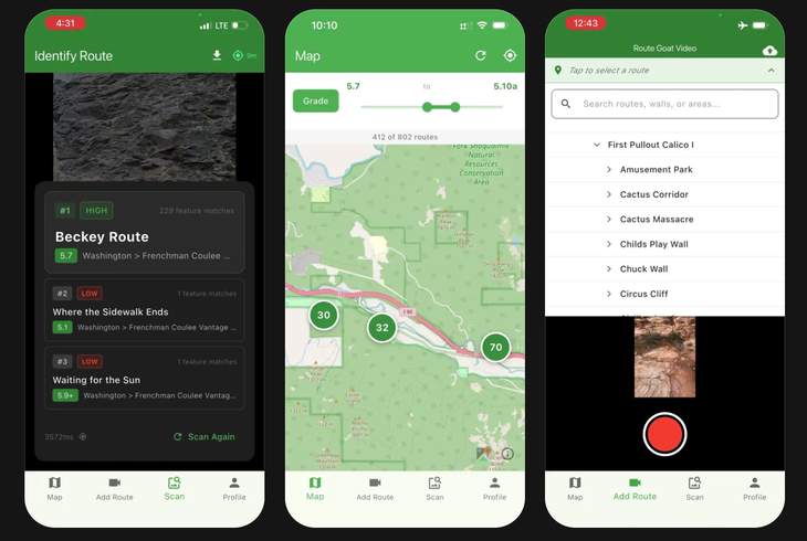
Frei isn’t alone in his belief that spatial data can enhance the transmission of information. Hunter Battle, the creator of the RouteGoat app, saw how easily modern phones could identify images of plants.
“If we can do it for plants,” he thought, “we can do it for rocks.”
After spending a year developing the software, Battle is now scouting for data all around the Pacific Northwest, adding hundreds of climbs a week to his database that stretches from Squamish to Phoenix.
Battle’s own frustrating experiences puttering around at the base of the crag searching for routes inspired him to create his app. However, he believes that RouteGoat will most benefit new outdoor sport climbers, fresh out of the gym.
“It’s pretty intimidating, and it definitely makes you feel stupid if you can’t find your route,” he said. “I’m just trying to lower the barrier for those people.”
Pearman too, believes that these new technologies will not only make climbing more accessible, but safer, too. In surveying individuals who had climbed Red Shirt, Pearman found that 15% of the people he talked to had gone off route. Another 35% had almost done so. Of the seven climbers who test-ran his app, none reported straying from the route.
As with all information technology, the goal is to help climbers make better decisions in the situations they face. Yet, more data does not always make for better climbing.
“The point of the tool is to make you more prepared,” said Pearman, but “the more prepared you are, the less of an adventure it is.”
So, does more data mean a better climbing experience?
The debate between thrill and safety is almost as old as climbing itself, but for Bee Carol, a climbing guide in the UK, the introduction of this new technology is about more than just the culture wars that ignite on Mountain Project forums.
“For people who have done a lot of climbing already, I think this kind of app can smooth the process of finding routes,” said Carol. Yet, she adds that “if you are learning to climb at the outset, finding where to go and finding the route and figuring it out is a really big part of the learning process. It’d be detrimental if that’s skipped.”
Already, technology has done a lot of smoothing. GPS and satellites have allowed climbers to think less about navigating to a climb and more about climbing. As we keep leaning on crutches rather than exercising our own abilities, we become more and more dependent on that technology. Andy Genereux, a guidebook author in the Rockies and a climber of over 50 years, believes this over-reliance on technology poses a risk greater than getting lost in the first place.
“When the technology goes dead on you, you don’t have that skill set to figure it out,” Genereux said. “Now [you’re] up the creek without a paddle.”
This may be true for technologies of the past. However, as apps like ThreeTopo come onto the playing field, proponents maintain that the three-dimensional nature of these platforms are more conducive to how human brains process information. This makes these apps far more powerful learning tools than 2D maps, for example.
For Frei, the founder of Rock Garden, these new technologies are not a replacement for navigation or sound judgement. Their purpose is to help people better understand and explore the rocks they climb.
If you “take away that scary demon of the unknown,” Frei reflected, “there’s this whole world of rock, and climbing in particular, that is just waiting to be discovered.”
The post Are 3D Topos and AI Climbing Assistants the Future of Climbing? appeared first on Climbing.