 BURST
BURST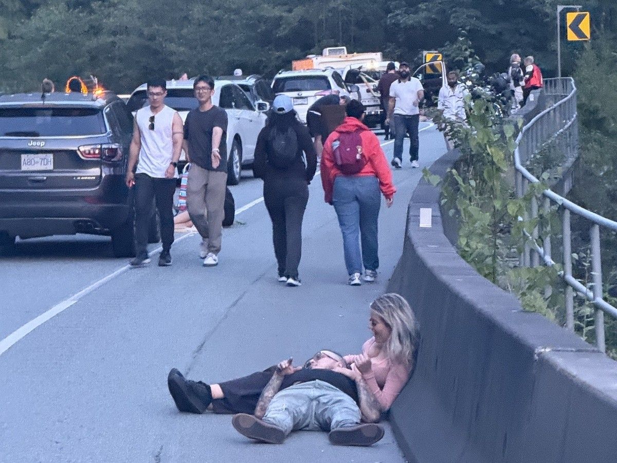
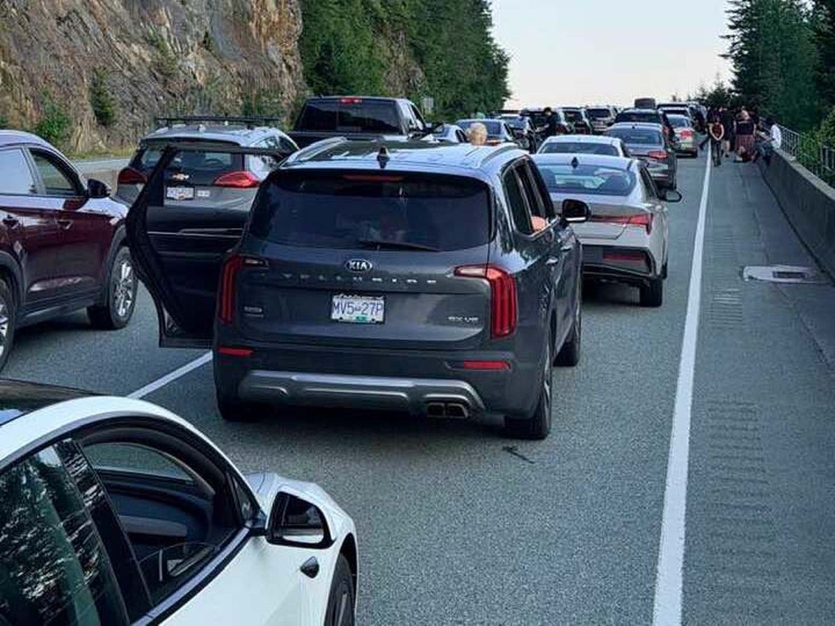
After drivers were stranded for eight hours on the Sea to Sky Highway following a motorcycle fatality last Sunday , one thing is certain: Getting stuck on that highway during a prolonged investigation is not just uncomfortable, it is unsafe.
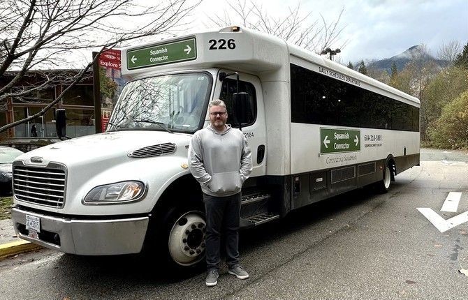
Matthew Paugh, operations manager for Squamish Connector shuttle bus, fielded 100 requests for places to stay from stranded motorists, hosted four people overnight in his Squamish home, and one of his drivers slept in the office.
“People need water, they need food, medication, insulin,” said Paugh.
Experts are calling for change that would allow traffic to keep flowing, even when a detailed police investigation is required.
The Sea to Sky Highway, the only corridor between Vancouver and Whistler, lacks sufficient refuge and diversion areas to allow for traffic turnarounds, according to Gargoum Suliman, a transportation engineer and UBC assistant professor.
The highway could be widened, but the geography presents significant constraints, said Suliman. “There are some areas where it is not structurally sound to cut through the mountain.”
The route from Horseshoe Bay to Whistler was significantly overhauled in 2009, ahead of the 2010 Olympics. The $600 million project added 71 kilometres of new passing lanes and dozens of new bridges.
In April 2026, the Insurance Corp. of B.C. provided Postmedia with data showing there had been 167 crashes between Vancouver and Whistler in 2024, up from 156 in 2021, with about half of them leading to injury or death. There were 396 unplanned road closures during the five-year period from 2011 to 2016. Ten per cent of those were full closures.
When a serious injury or fatality occurs, a detailed investigation is required.
“It is considered a crime scene when someone is killed, and locations are treated as such in those cases,” said Suliman.
Suliman believes the use of lidar technology — a 3D laser that creates a full-dimensional model of the scene — could speed up investigations so lanes could be cleared.
But RCMP Cpl. Michael McLaughlin, spokesperson for the RCMP’s highway patrol , said technology gaps are not contributing to delays in complex fatality investigations, and that the operational debrief following this accident will discuss road closures, policy for dealing with traffic delays, and whether more “efficiencies” can be applied for future serious highway shutdowns.
The Independent Investigations Office of B.C., which investigates “incidents of death or serious harm that may have been the result of the actions or inactions of a police officer,” sent officials to the scene on Sunday. B.C. RCMP said one of their highway patrol officers conducting speed enforcement “left their position along the highway and moments later located one of the motorcyclists who was involved in a collision with a recreational vehicle.”
“While we recognize the inconvenience, our priority is to complete investigations thoroughly and safely without compromising evidence or the integrity of the investigative process,” the Investigations Office said.
According to the Ministry of Public Safety, traffic control was in place following Sunday’s incident, which occurred near Deeks Creek Bridge south of Porteau Cove.
“Most vehicles had the opportunity to turn around using existing interchanges, overpasses, median crossover locations, side roads, and undivided sections of highway.”
Paugh, who manages the Sea to Sky Road Conditions Facebook group, said many drivers had no information on how to access those turnarounds, and many couldn’t access Drive B.C.’s online updates due to spotty cell service.
One of his subscribers, Sepehr Sarraf, who was stuck in the traffic for eight hours, called the situation “reckless and unacceptable … endangering thousands of people stuck on the route.”
Paugh has gathered over 5,000 signatures on a petition asking for improved signs at turnaround locations, including Porteau Cove, Eagle Bluffs, West Vancouver/Horseshoe Bay, Tantallus Lookout and Salt Shed. He is calling for the implementation of an average-speed camera system.
The system calculates the average speed of vehicles over a stretch of highway, rather than at a single point, and uses “automatic licence plate recognition” cameras to record when a vehicle enters and exits a zone, eliminating the possibility of evading known radar detection spots.
B.C. is conducting an average-speed camera pilot project on Highway 5 North between Kamloops and Avola. The system is used extensively in Scotland, the Netherlands, Italy, France, Kuwait and the Middle East, and has been shown to be highly effective in reducing fatal and serious collisions, but has been called a cash grab by critics and raised issues about privacy.
Paugh is also calling for the installation of gates in sections where there are median barriers, to increase places to turn cars around.
In a statement, the Transportation Ministry said: “Following significant incidents, response efforts are reviewed to identify opportunities to improve traffic management, communications and emergency response procedures while maintaining safety as the top priority. The ministry will continue to work with RCMP and the Ministry of Public Safety to assess how to better facilitate access to existing turn-around locations during emergency events.”
Suliman would like a full geometric assessment of the entire Sea to Sky corridor, cross-referenced with collision data of the last three to five years, to determine which locations and counter-measures could be applied.
“Traffic is not going to go anywhere. It’s a critical highway and safety is a priority,” said Suliman.